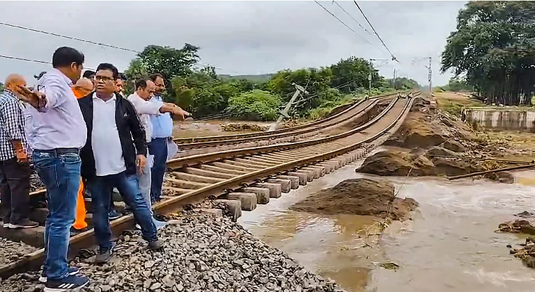
A well-marked low pressure belt that formed over central India is bringing heavy to extremely heavy rainfall in Uttarakhand, Uttar Pradesh and their adjacent region and will continue to do so over the next two to three days, the India Meteorological Department (IMD) said on Thursday.
Weather Updates: Intense Rainfall Alert In Bengal, UP, Uttarakhand; Orange Alert In Delhi
Two well-marked low-pressure areas formed over Central India and northeast Bay of Bengal respectively are behind the heavy torrential rainfalls across states which are expected to persist for the next few days, according to the India Meteorological Department (IMD)

Besides, another well marked low pressure area formed over the northeast Bay of Bengal is also likely to cause isolated very heavy to extremely heavy rainfall over Gangetic West Bengal & Odisha for next one week.
According to the IMD's bulletin yesterday, the low pressure system of central India was located around 50 kilometres south-southeast of Agra and 50 kilometres north-northeast of Gwalior. As per predictions, it moved towards the north-northeast direction and gradually weakened today.
According to Skymet, a private weather forecasting agency, the system was likely to re-curve northeastward, away from the national capital, towards west Uttar Pradesh and Uttarakhand.
The weather department warned of moderate to high risk of flash floods in several areas, particularly in parts of west Uttar Pradesh, east and west Madhya Pradesh.
Places to receive heavy rains
In line with IMD's prediction, both Uttar Pradesh and Uttarakhand experienced very heavy rainfall in past 24 hours with red alerts being issued at several areas. Delhi on Friday received an orange alert, said IMD.
Besides, Haryana is also expected to see light to moderate rain, with heavy rainfall at times between September 12 and 15. Madhya Pradesh and West Rajasthan is also expected to experience heavy rainfall.
According to the Meta department, surface runoff and flooding may occur in low-lying, fully saturated areas due to the rainfall while localised flooding of roads, waterlogging in low-lying areas, and the closure of underpasses, especially in urban regions could be triggered by the heavy rains.
Traffic disruptions are likely due to waterlogged roads, and visibility may be reduced in some areas. Minor damage to kutcha (unpaved) roads and vulnerable structures is possible, along with landslides and damage to crops due to the rain and wind, the IMD said.
- Previous Story
 Elections 2024: Ashok Tanwar Joins Congress Again; Sehwag Endorses Congress Candidate In Haryana
 - Next Story


